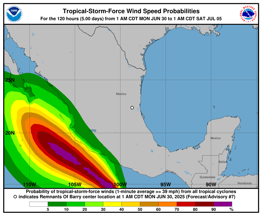
...BARRY DISSIPATES OVER EASTERN MEXICO... ...HEAVY RAIN STILL EXPECTED TO CONTINUE THROUGHOUT THE DAY... SUMMARY OF 400 AM CDT...0900 UTC...INFORMATION ---------------------------------------------- LOCATION...23.0N 99.2W ABOUT 100 MI...160 KM NW OF TAMPICO MEXICO MAXIMUM SUSTAINED WINDS...30 MPH...45 KM/H PRESENT MOVEMENT...NW OR 305 DEGREES AT 12 MPH...19 KM/H MINIMUM CENTRAL PRESSURE...1008 MB...29.77 INCHES WATCHES AND WARNINGS -------------------- There are no coastal watches or warnings in effect. DISCUSSION AND OUTLOOK ---------------------- At 400 AM CDT (0900 UTC), the remnants of Barry were located near latitude 23.0 North, longitude 99.2 West. The remnants are moving toward the northwest near 12 mph (19 km/h). Maximum sustained winds are near 30 mph (45 km/h) with higher gusts. The estimated minimum central pressure is 1008 mb (29.77 inches). HAZARDS AFFECTING LAND ---------------------- RAINFALL: The remnants of Barry are expected to produce additional rainfall totals of 3 to 5 inches, with isolated maximum totals of 8 inches, across portions of the Mexican states of San Luis Potosi and Tamaulipas through today. This rainfall may produce life-threatening flooding and mudslides, especially in areas of steep terrain. For a complete depiction of forecast rainfall and flash flooding associated with this system, please see the National Weather Service Storm Total Rainfall Graphic, available at hurricanes.gov/graphics_at2.shtml?rainqpf NEXT ADVISORY ------------- This is the last public advisory issued by the National Hurricane Center on Barry.
REMNANTS OF BARRY FORECAST/ADVISORY NUMBER 7 NWS NATIONAL HURRICANE CENTER MIAMI FL AL022025 0900 UTC MON JUN 30 2025 REMNANTS OF CENTER LOCATED NEAR 23.0N 99.2W AT 30/0900Z POSITION ACCURATE WITHIN 25 NM PRESENT MOVEMENT TOWARD THE NORTHWEST OR 305 DEGREES AT 10 KT ESTIMATED MINIMUM CENTRAL PRESSURE 1008 MB MAX SUSTAINED WINDS 25 KT WITH GUSTS TO 35 KT. WINDS AND SEAS VARY GREATLY IN EACH QUADRANT. RADII IN NAUTICAL MILES ARE THE LARGEST RADII EXPECTED ANYWHERE IN THAT QUADRANT. REPEAT...CENTER LOCATED NEAR 23.0N 99.2W AT 30/0900Z AT 30/0600Z CENTER WAS LOCATED NEAR 22.4N 98.7W FORECAST VALID 30/1800Z...DISSIPATED REQUEST FOR 3 HOURLY SHIP REPORTS WITHIN 300 MILES OF 23.0N 99.2W THIS IS THE LAST FORECAST/ADVISORY ISSUED BY THE NATIONAL HURRICANE CENTER ON THIS SYSTEM
Expires:No;;630828 WTNT42 KNHC 300831 TCDAT2 Remnants Of Barry Discussion Number 7 NWS National Hurricane Center Miami FL AL022025 400 AM CDT Mon Jun 30 2025 Barry made landfall around 0100 UTC just south of Tampico, Mexico. The intensity at landfall is uncertain, but it was likely around 30 or 35 kt when the center reached the coast. Since moving inland, satellite images and surface observations indicate that the low-level circulation has dissipated over the rugged terrain of eastern Mexico. Therefore, Barry is no longer a tropical cyclone and this is the last NHC advisory. Although the associated deep convection has decreased, there are still some small clusters of heavy rain. In fact, radar images show a mesoscale convective vortex over eastern Mexico associated with Barry’s remaining mid-level circulation. The remnants of Barry will likely continue to produce heavy rainfall over portions of northeastern Mexico throughout the day, potentially causing flooding and mudslides. FORECAST POSITIONS AND MAX WINDS INIT 30/0900Z 23.0N 99.2W 25 KT 30 MPH...INLAND 12H 30/1800Z...DISSIPATED