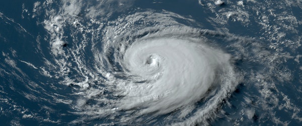
Hurricane Beryl’s Unprecedented Early Season Impact Signals Climate Concerns
Tuesday, July 2nd, 2024 Catastrophe Property Risk ManagementHurricane Beryl has shocked meteorologists by becoming a Category 5 storm early in the Atlantic hurricane season, with sustained winds of 165 mph. Traditionally, such intense hurricanes form later in the season when sea temperatures peak in August and September. However, the Atlantic Ocean’s unusual warmth has accelerated Beryl’s development, making it the earliest Category 5 hurricane ever recorded in the region. Beryl’s rapid intensification from a tropical depression to a major hurricane in just 48 hours is unprecedented for this time of year. The storm is currently moving through the Caribbean Sea toward Jamaica and may impact Mexico’s Yucatan peninsula before weakening in the Gulf of Mexico.
Meteorologists attribute Beryl’s early formation and intensification to abnormally high sea temperatures and the influence of La Niña. The unprecedented conditions have led experts to predict an exceptionally active hurricane season, with heightened risks for coastal regions in the United States, Mexico, and the Caribbean. This early season storm underscores the broader implications of climate change on hurricane activity, with scientists predicting more frequent and intense storms as global temperatures rise.
Beryl’s development serves as a stark reminder of the potential for more extreme weather events in a warming world, highlighting the need for increased preparedness and adaptation measures in vulnerable coastal areas.


